THE LAST MERIDIAN

A fictional field report built around survey data, navigation failure, and the discovery of an unmapped boundary.

PROJECT DETAILS
The Last Meridian
2026
Concept-driven environmental poster
Adobe Photoshop, Adobe Illustrator, Adobe After Effects
DELIVERABLES
Final Poster / Development Stages / Image Treatment / Texture & Surface Studies / Symbols & Markers / Color System Animation / Title Treatment / Report System / Information Hierarchy / Mockup Presentation
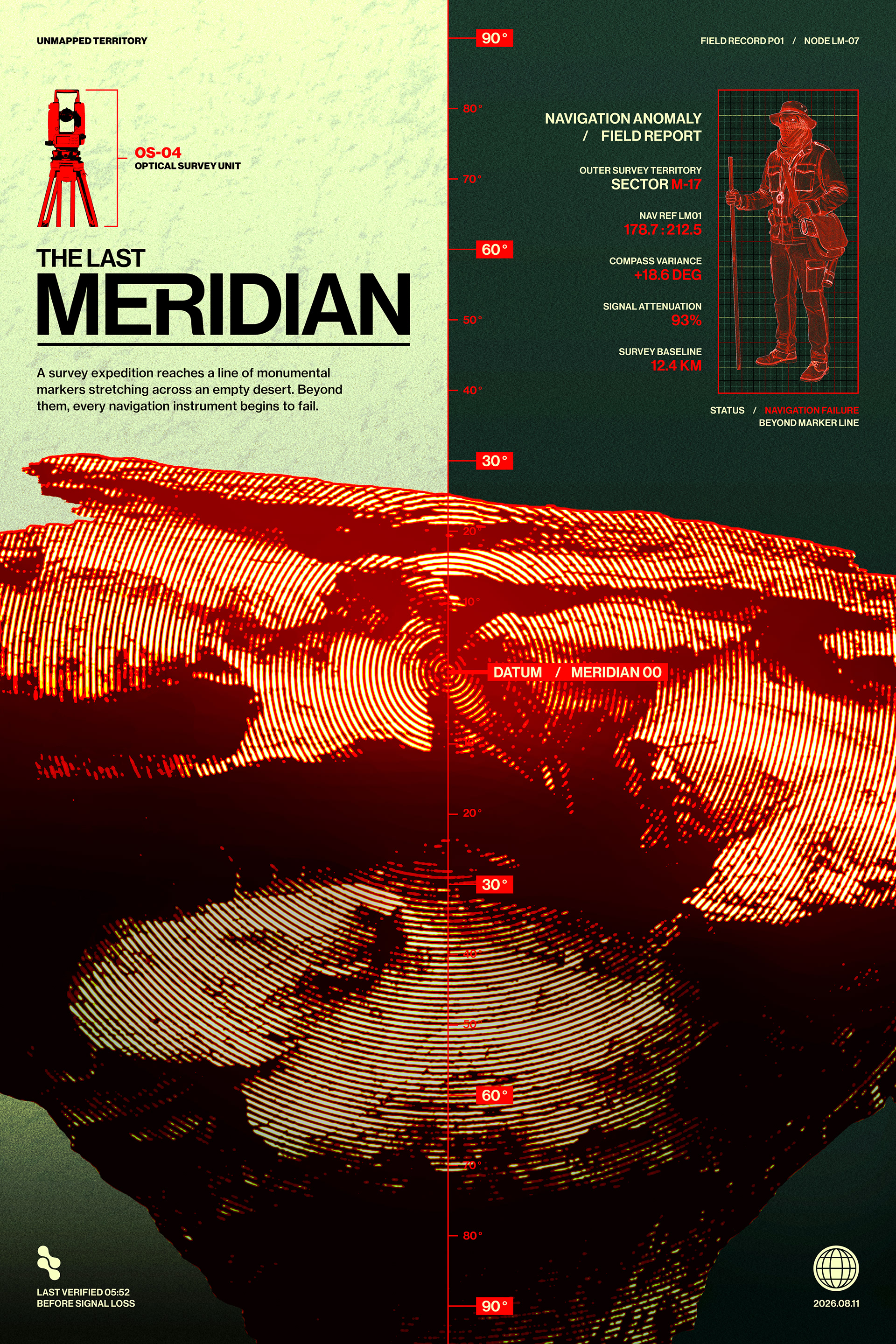
The Last Meridian imagines a survey expedition reaching a line of monumental markers in an empty desert. Beyond that point, navigation begins to fail. The poster is presented as a fragment of that fictional expedition: part field report, part warning document, and part visual record of a territory that can no longer be measured reliably.
The Story
The narrative begins with surveying: coordinates, optical instruments, compass readings, field records, and angular measurements establish a controlled system for understanding space. As the expedition approaches Meridian 00, that system begins to fail. Signal attenuation rises, compass readings drift, and positional certainty begins to collapse. The central meridian functions as both a measurement axis and the narrative boundary between mapped territory and the unknown.
The Last Meridian poster with acid-green and dark-green fields, red survey graphics, a field surveyor, and high-contrast bitmap desert terrain.

Final poster combining the field-report narrative, survey graphics, and processed terrain into a single visual system.
VISUAL LANGUAGE
The visual language combines precise technical graphics with high-contrast bitmap terrain. Oversized sans-serif typography establishes the title, while coordinates, status labels, measurements, and field notes create a secondary information layer. Acid green, dark green, red, black, and cream give the poster an archival yet synthetic character. Red isolates warnings, measurements, and critical readings, while the landscape is reduced to dense line structures so it appears recorded through an instrument rather than photographed conventionally.
From Concept to Final
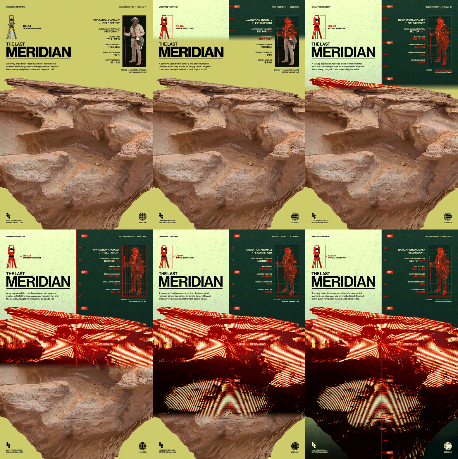
The poster develops from an initial photographic composition into a fictional field-report system. Early stages establish the landscape, title hierarchy, and expedition narrative, while later stages introduce bitmap processing, survey graphics, technical metadata, color, and navigation-failure details.
Animated progression showing The Last Meridian evolving from photographic source imagery into the finished field-report poster system.
Source landscape to bitmap treatment, survey graphics, typography, metadata, and final composition.
KEY DEVELOPMENT STAGES​​​​​​​
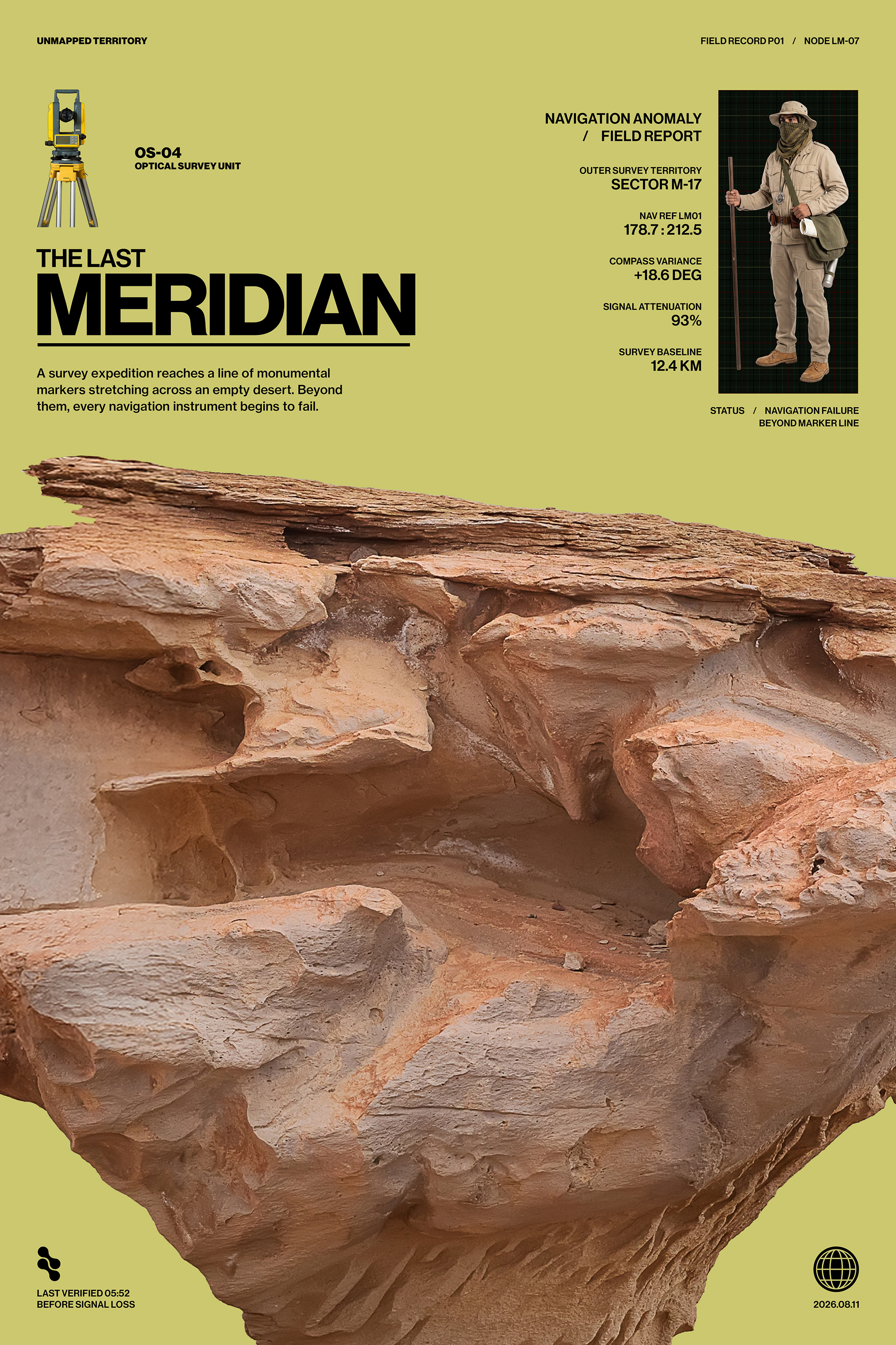
The four development stages below highlight key moments in the poster’s evolution, moving from the original photographic composition through bitmap image treatment, structural data integration, and the final field-report system.
Source & Initial Direction: Original desert photography establishes the first composition, scale, hierarchy, and narrative direction.
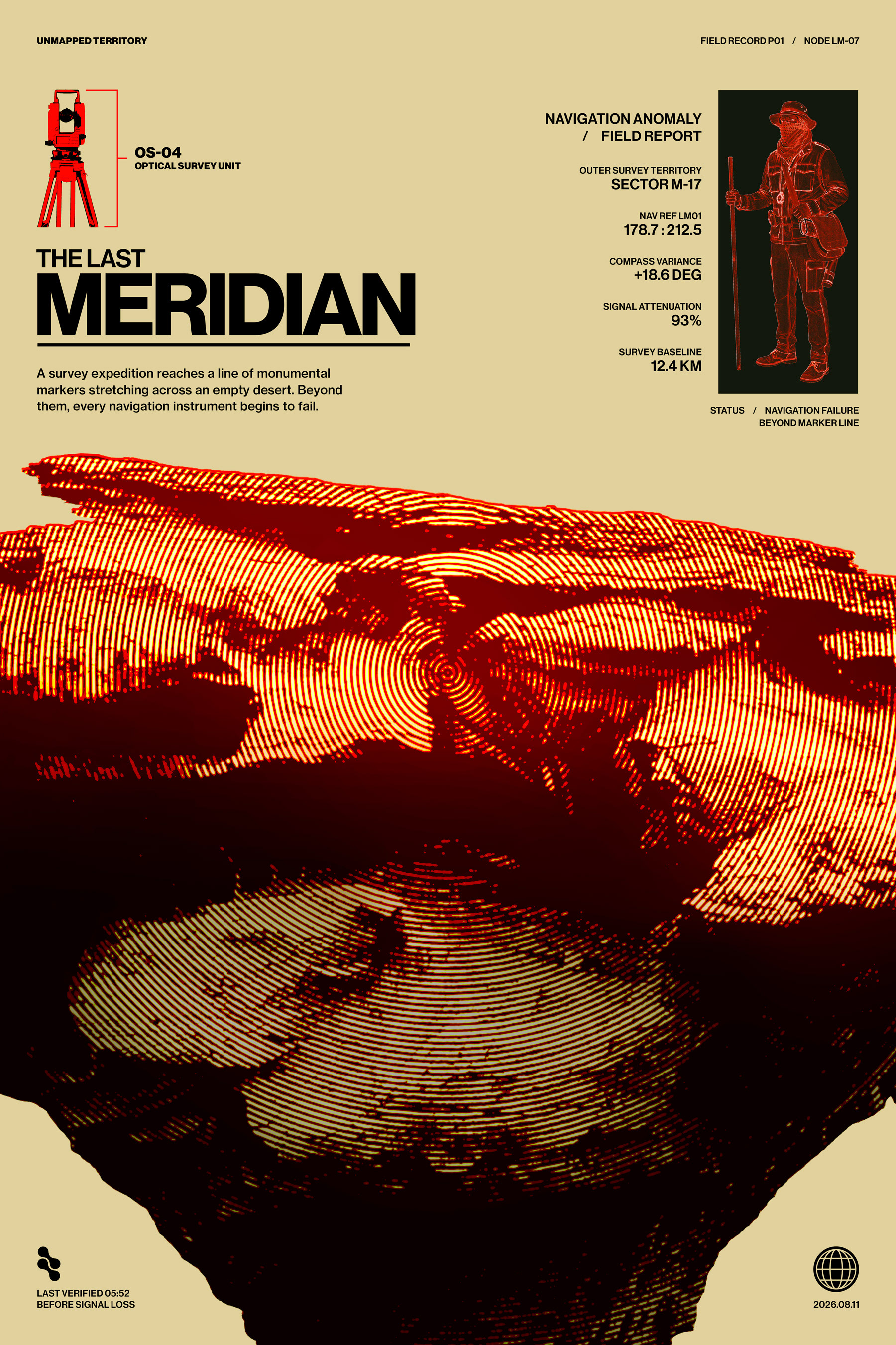
Image Treatment Development: The landscape is converted into a high-contrast bitmap treatment to shift it from photographic reference into a technical field-record aesthetic.
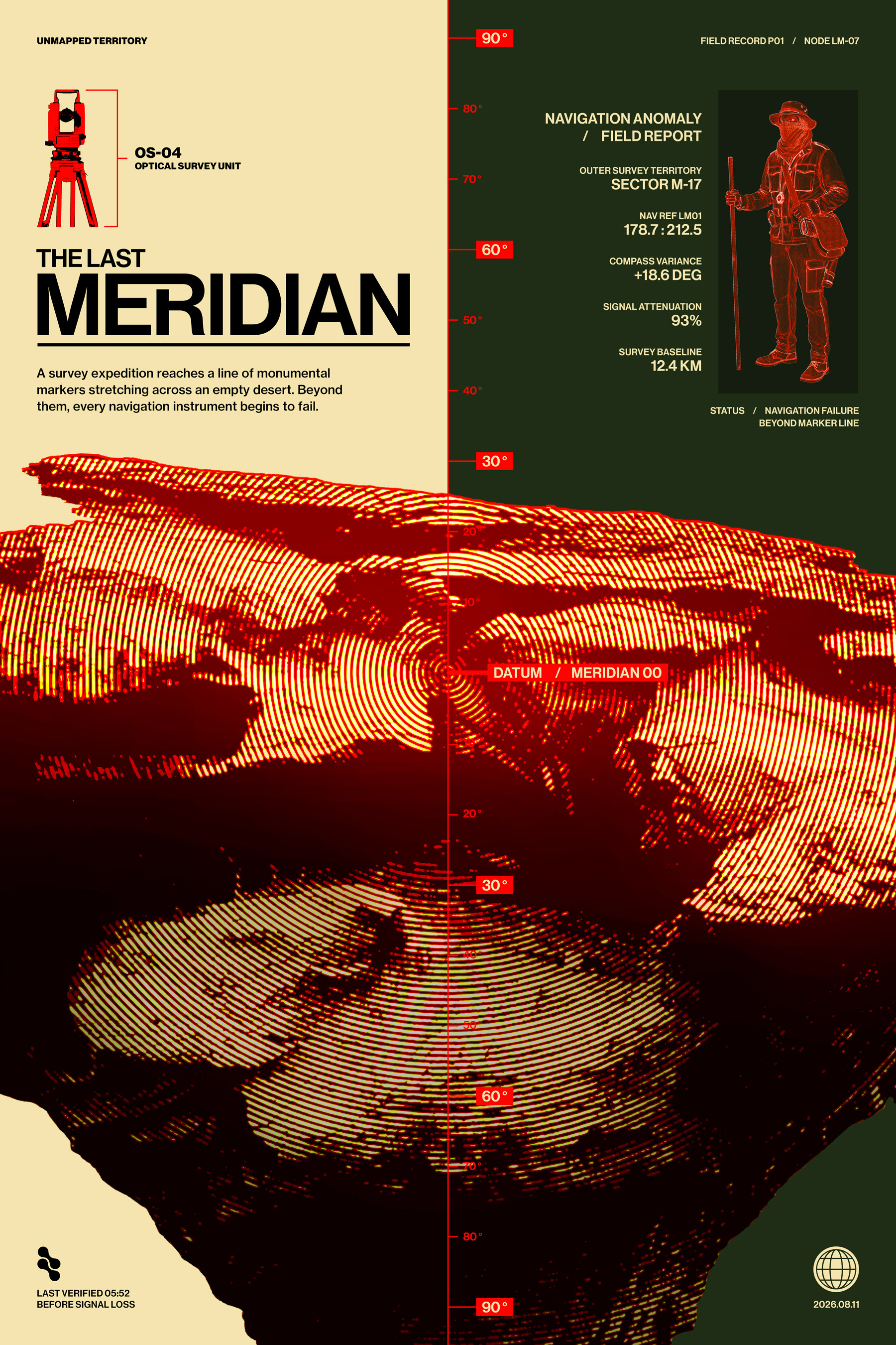
System & Data Integration: Survey graphics, the central meridian axis, split-field structure, and navigation metadata are introduced to connect the imagery with the fictional reporting system.
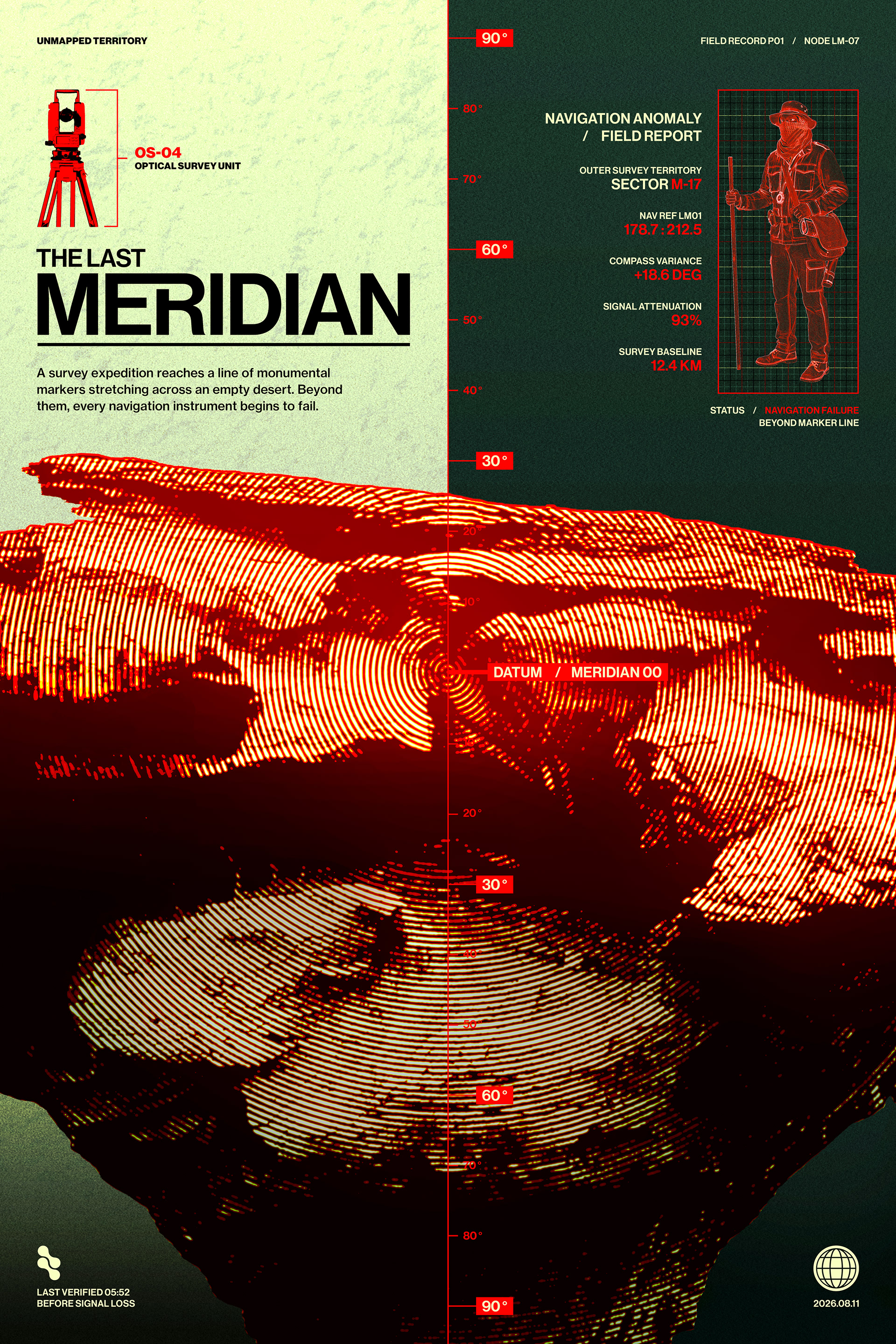
Final Composition: Texture, color, typography, measurement graphics, and environmental data are refined into the completed poster and unified around the narrative of navigation failure.
Each stage retains the same underlying composition while progressively replacing photographic realism with the visual language of surveying, measurement, and navigation failure.
Image Treatment
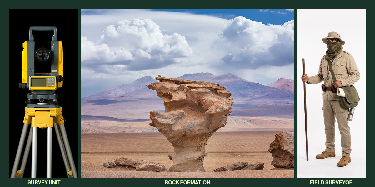
The source imagery is pushed away from photographic realism through cutout, tonal compression, bitmap conversion, and limited-color processing. The rock formation becomes a dense field of contour-like lines, while the surveyor and optical instrument are simplified into graphic forms that integrate with the surrounding data system.​​​​​​​
Source imagery for The Last Meridian showing an optical survey unit, eroded rock formation, and field surveyor before graphic processing.

Primary source images used to construct the survey unit, rock formation, and field surveyor before processing and graphic integration.
Texture & Surface
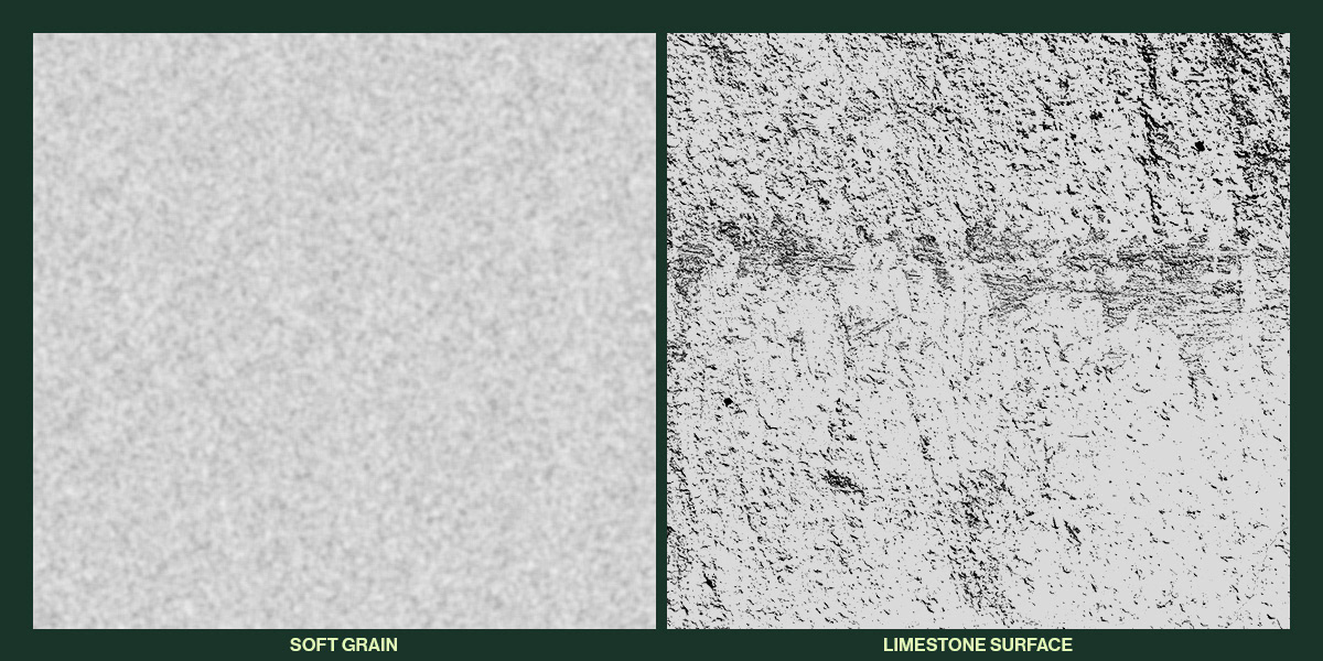
Surface treatments introduce grain and weathering throughout the poster, softening its digital precision and giving the field report a more tactile, recovered quality.
Soft grain and high-contrast limestone textures used to add weathering and tactile surface variation to The Last Meridian.

Soft grain and limestone textures introduce weathering, tactile variation, and a field-worn surface quality.

Color System
The palette combines acid green, dark green, red, and black. Acid green establishes the lighter survey field, while dark green and black structure the denser report zone. Red is reserved for warnings, measurements, coordinates, and critical system values.
Color system for The Last Meridian showing red, acid green, dark green, and black used throughout the poster.
Typography
Typography is divided between an assertive display treatment and a compact technical information system. Large-scale type establishes the project identity, while smaller uppercase labels, measurements, coordinates, and status readings organize the fictional field report.
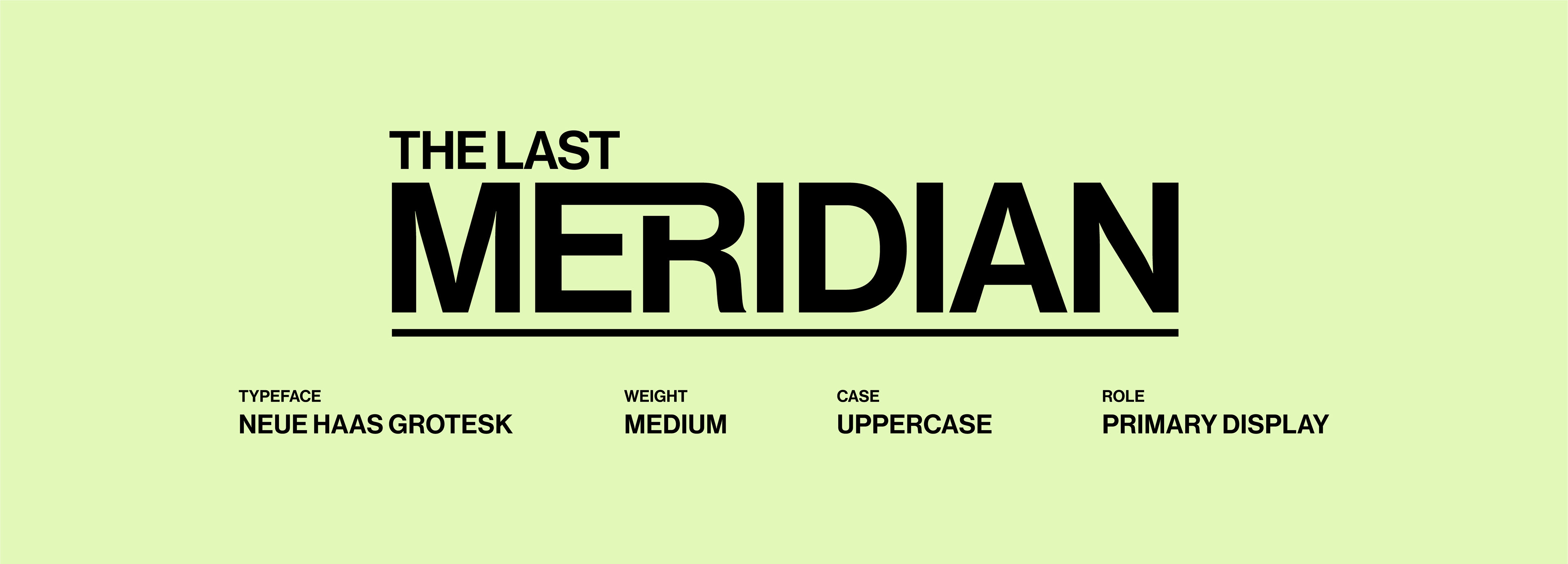
TITLE TREATMENT
The title is built around a deliberate contrast in scale. “THE LAST” acts as a compact lead-in, while “MERIDIAN” expands across the composition to become the poster’s primary typographic anchor. The underline establishes a firm baseline and reinforces the measured, diagrammatic character of the field-report system.
The Last Meridian title treatment using Neue Haas Grotesk Medium in uppercase, with oversized MERIDIAN, an underline, and type specifications.

Scale contrast and underlining establish the title as the poster’s primary visual anchor.
REPORT SYSTEM
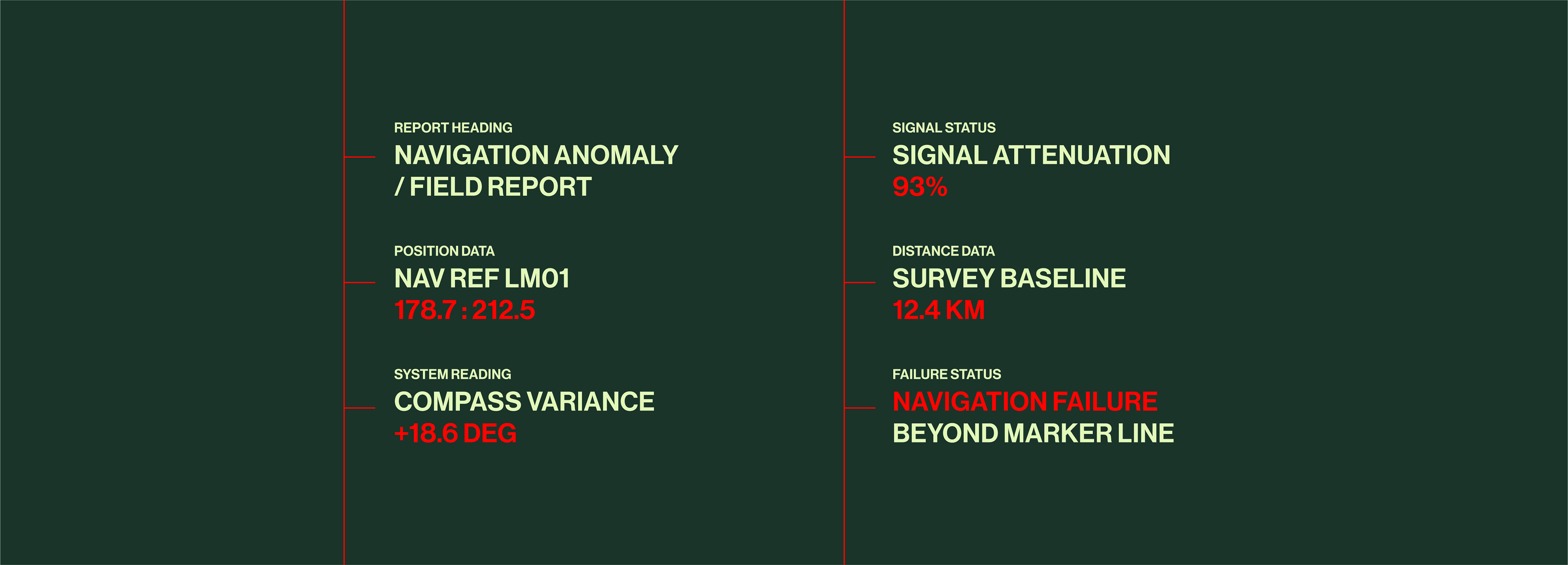
A secondary information system carries coordinates, field IDs, measurements, status labels, and warnings throughout the composition. Changes in scale, weight, alignment, and color distinguish descriptive information from critical readings, allowing the type to function as both information design and narrative worldbuilding.
Field-report typography system showing navigation headings, coordinates, compass variance, signal attenuation, survey distance, and navigation failure data.

Technical labels, measurements, coordinates, and status readings form the poster’s secondary information system.
INFORMATION HIERARCHY
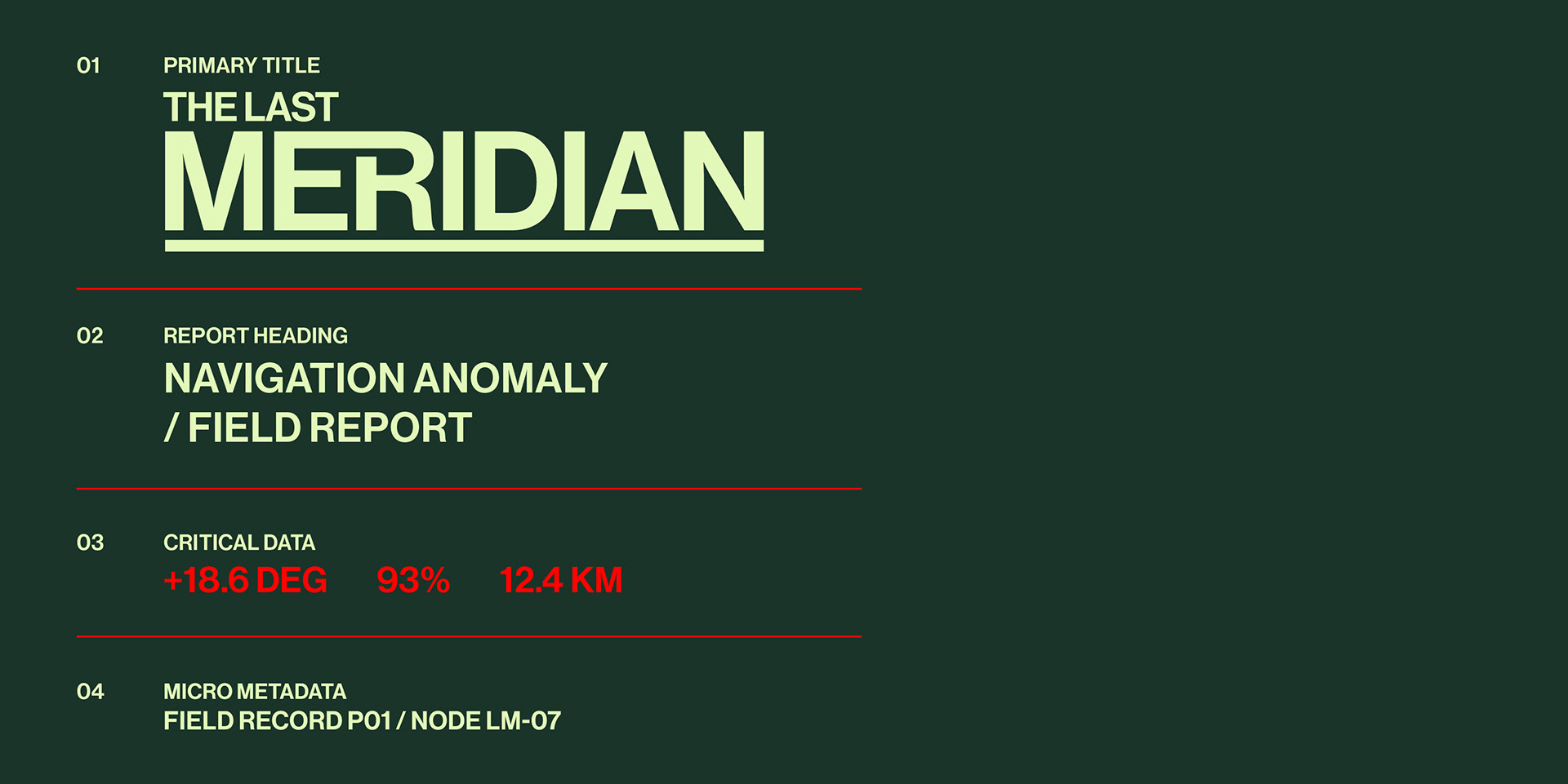
Four levels of information guide the viewer from immediate project recognition to increasingly specific field data. Scale, weight, placement, and color establish clear differences between the title, report headings, critical readings, and supporting metadata.
Four-level information hierarchy showing the primary title, report heading, critical data, and micro metadata used in The Last Meridian.

Four levels of type establish a clear progression from primary project identity to detailed field metadata.
Symbols & Markers
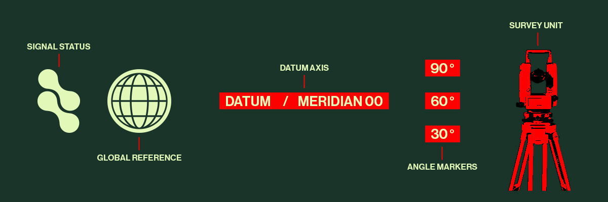
A compact set of symbols, measurement markers, and reference graphics extends the field-report system across the poster. Each element supports navigation, positioning, status, or surveying while reinforcing the visual language of the fictional expedition.
Reference graphic system showing signal status, global reference, datum axis, angle markers, and the optical survey unit.

Core reference graphics used to communicate signal status, geographic position, measurement, and surveying within the fictional field-report system.
IN CONTEXT
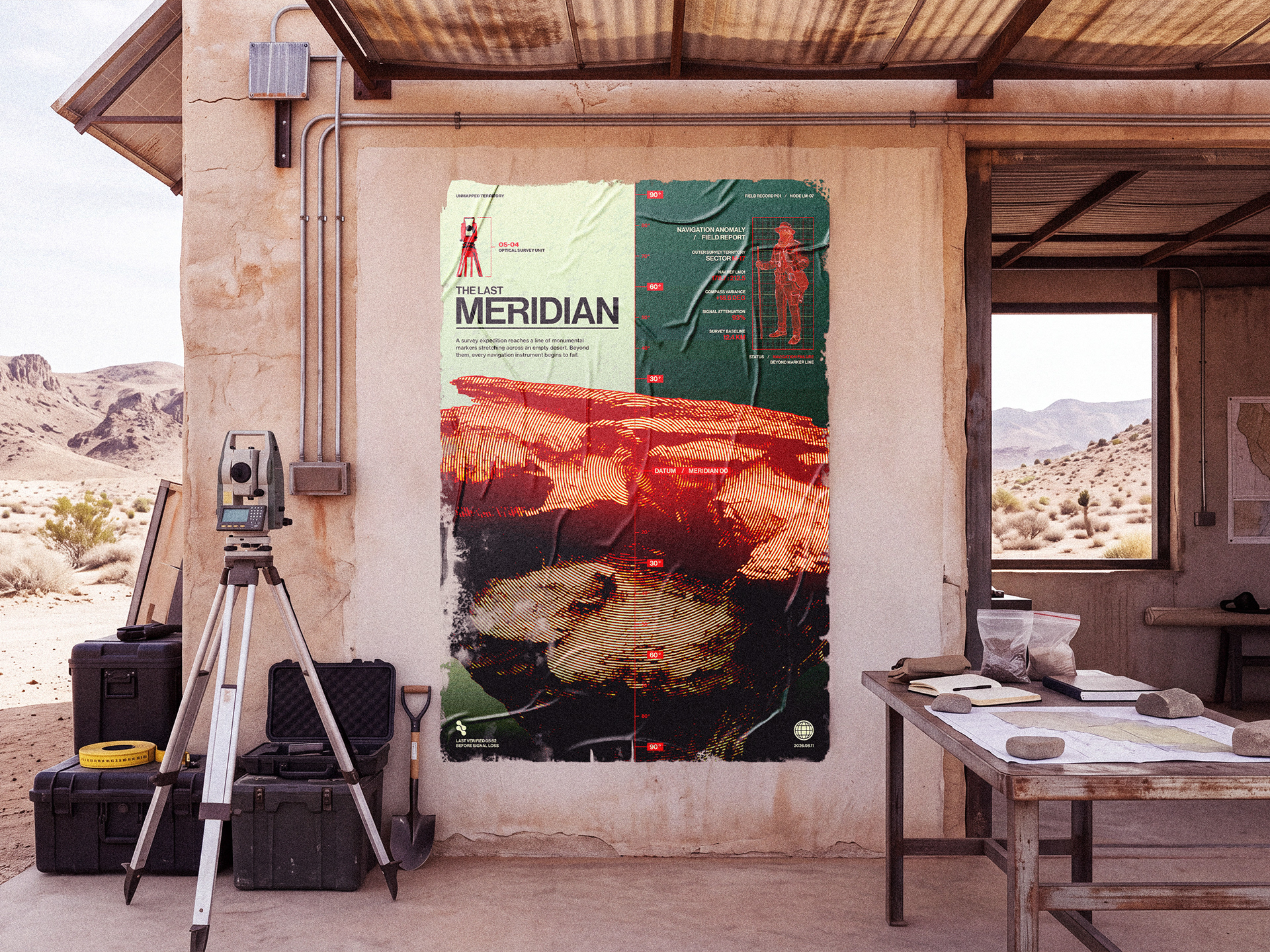
The poster is presented within a remote desert survey station to extend the fictional field-report narrative beyond the page. Survey equipment, field cases, maps, and the surrounding terrain reinforce the idea of an expedition documenting an environment where navigation and measurement begin to fail.

Final poster presented within a remote desert survey station.

OUTCOME
The final poster brings image treatment, typography, survey data, color, and texture into a single fictional reporting system. Each element supports the same narrative: a controlled attempt to measure an environment that becomes less reliable as the expedition approaches Meridian 00. The result functions both as a graphic poster and as an artifact from the world it describes
Have a project in mind?
Get in touch to discuss how we can bring it to life.
Back to Top